Theodore Roosevelt National Park: Tuesday, June 29th
Dragged the kids, bleary-eyed, from their beds at 8:30 because the Opela’s were getting ready to leave and they would never have forgiven us if they’d missed saying Goodbye. After they left, it was one of the rare times that we told Becca she was not allowed to go back to bed, even though she wanted to, late night much?!
They worked on their journals and Junior Ranger books. It was certainly a morning to stay inside, the temperature got up to about 94° and with little breeze or shade outside, stepping from the camper was like walking into an oven.
After Dave finished work, we drove over to Theodore Roosevelt National Park, named for the 26th President of the United States; it covers 110 square miles of breathtaking vistas in the savagely beautiful North Dakota Badlands. We arrived in time for a short tour around the Maltese Cross Cabin. Ranger Kevin gave us some good information about its original occupant. Theodore Roosevelt first arrived to hunt buffalo in September 1883, immediately fell in love with the land, and invested in cattle raising. He returned here from New York after the deaths of his mother and wife on Valentine’s Day, shortly after the birth of his daughter. The cabin was too close to the throughway and he received too many visitors in his time of grieving so he requested a location much further away and moved out to Elkhorn, where he enjoyed the peace and quiet of the land.


In 1901 Roosevelt, at age 42, became the youngest president in US history, serving until 1909. He called his years in the badland ‘the romance of my life,’ and often credited his Dakota experiences with enabling him to become president, saying, after he left the Presidency, “I never would have been President if it had not been for my experiences in North Dakota.”
The park allows visitors to learn about an environment and way of life that helped shape Theodore Roosevelt’s attitudes and philosophy regarding conservation. The prospect of big game hunting had initially brought Roosevelt to the West. But when he returned, the last large herds of bison were gone, having been decimated by hide hunters and disease. By spending time in the Dakota Territory, he became alarmed by the damage that was being done to the land and its wildlife. He witnessed the destruction of some big gamed species. Overgrazing destroyed the grasslands and with them the habitats for small mammals and songbirds. Conservation increasingly became one of Roosevelt’s major concerns. When he became President in 1901, Roosevelt pursued his interests in conservation and resource protection by establishing the US Forest Service and by signing the 1906 Antiquities Act under which he proclaimed 18 national monuments. He also established 5 national parks, 51 Federal Bird Reservations, 4 National Game Preserves, and 150 National Forests. By the end of his presidency, he had protected 230,000,000 acres of public land!


The children learned quite a bit through their Junior ranger books, for example, a New York City toy company decided to name a toy in honor of him, Teddy is a nickname for Theodore, hence ‘teddy-bear’ came into being. They also learned about the branding of cattle and the different symbols associated with the ranches of the time, along with the fact that cattle of multiple different ranches would graze together, hence the need for branding. A reminder of what they saw in the Petrified Forest was the large trunk base of a petrified cypress tree in the Visitor Center.


There is a 36 mile loop around the South Unit of the park, we are 70 miles from the North Unit. We checked out the Skyline Vista and River Woodland Overlook, then drove past a number of Prairie Dog Towns, fields of little mud piles of prairie dog ‘houses’, with little heads popping up and little brown critters running across the grass. At the Badlands Overlook, another girl was there, taking a picture with her 'roaming gnome'! She squealed when she saw Caitlin's, both she and Dave took pictures with them together! As we continued on, we passed lone bison wandering along the road side. They seemed a little scrawnier here than in Yellowstone, and the kids commented, "Oh, just one, where's the herd?" Yellowstone and Grand Teton have spoiled us for wildlife!


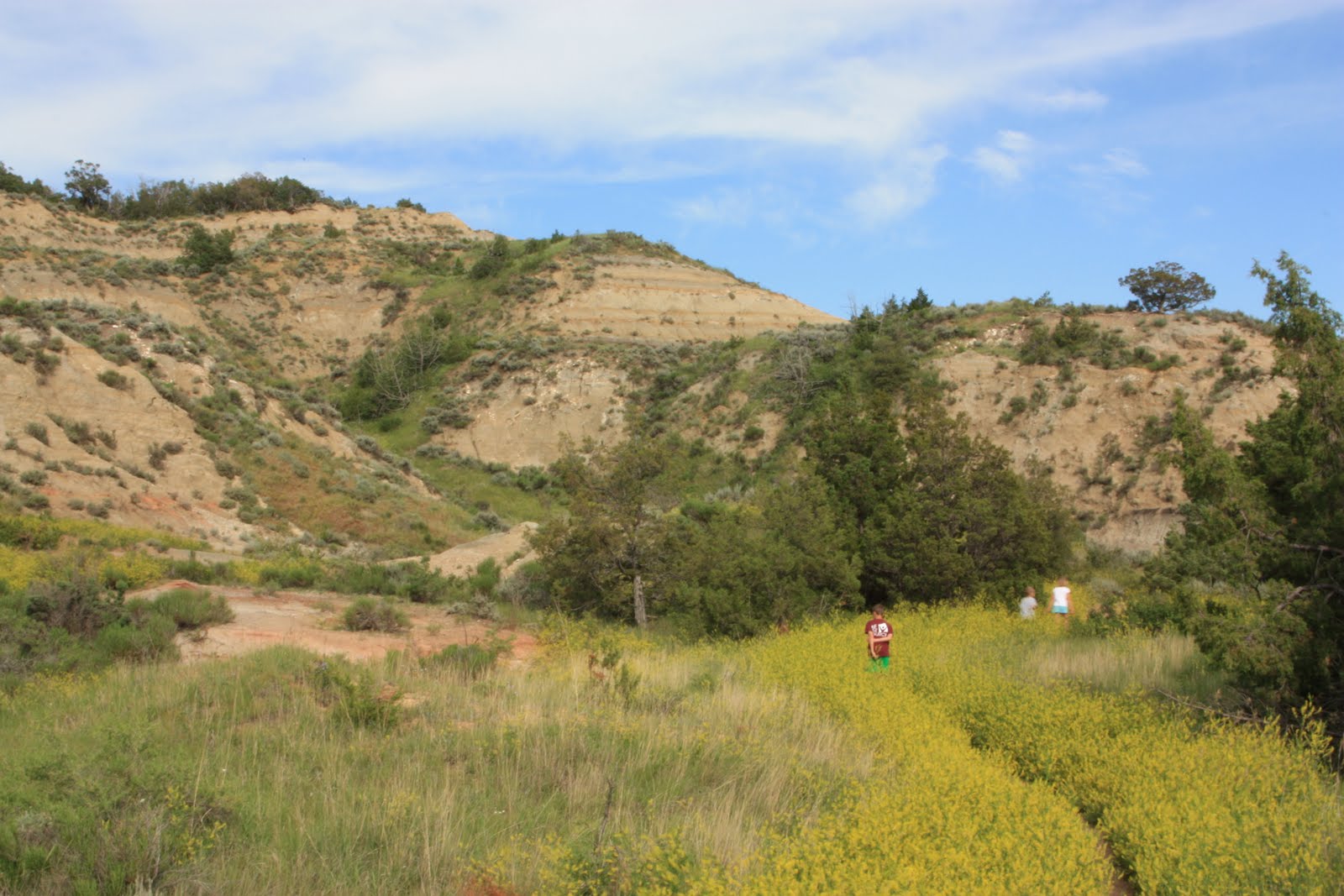
Our next stop was to hike the Coal Vein Trail. Prominent throughout the badlands are layers of brick-red rock, locally called ‘scoria’ but more properly termed clinker. Scoria, a dark, cinder-like lava, is not found in this region, which has never been volcanically active. Not so obvious are the bands of black lignite coal. The two materials are related. As far back as 9,000 years ago, exposed coal periodically caught fire, occasionally burning for decades. The heat from these fires baked the overlying rocks, reddening them and making them harder. The effects of a fire that burned here for 26 years (1951-1977) can be seen along the Coal Vein Trail.


As we followed the trail around, we also learned about how the land collapsed as the coal below the ground burned away, about the thick grayish-blue layer on the hillside being bentonite, also formed by fire and an excellent home for black widow spiders! We could find the beginning and ending point of the coal seam fire, this one was started by lightning – burning coal seams are a natural process in the badlands, apparently people roasted marshmallows on the glowing embers.


We also learned about lichens, consisting of two different kinds of plants – fungus and alga – the algae produce food and the fungi obtain water, they break down rocks into soil. Due to their sensitivity to impurities, park lichens have been studied to detect possible air pollution from area industries. The north facing slopes are cooler in the summer and dense vegetation on this side provides needed resting places for bird life and larger mammals.


Our last spot to look at was a large chunk of clinker: small pieces of ‘scoria’ were cemented together by exceptionally high heat. Over thousands of years, the action of water, wind and plants will slowly break down the formation. It was a great little mile trail.


From here, we continued our scenic drive, climbing to the top of Bunk Hill, only 100 yards (Jake let the kids know that was only the distance of a football field!) but extremely steep. It was incredibly windy at the top, however the views were truly incredible, such a vast expanse of land, covered with bumps of rock, buttes and stark areas of erosion.


We stopped at Boicourt Overlook on the way back, glimpsed wild horses in the distance, as well as a herd of pronghorn, a lone deer in the middle of another prairie dog town, an almost skinny-looking bison (look at those ribs!) and passed Peaceful Valley, the site of a horse ranch during the 1880’s heyday of cattle ranching, now the location for saddle horse rides throughout the park. The number of prairie dogs running around on the way out was crazy!


They worked on their journals and Junior Ranger books. It was certainly a morning to stay inside, the temperature got up to about 94° and with little breeze or shade outside, stepping from the camper was like walking into an oven.
After Dave finished work, we drove over to Theodore Roosevelt National Park, named for the 26th President of the United States; it covers 110 square miles of breathtaking vistas in the savagely beautiful North Dakota Badlands. We arrived in time for a short tour around the Maltese Cross Cabin. Ranger Kevin gave us some good information about its original occupant. Theodore Roosevelt first arrived to hunt buffalo in September 1883, immediately fell in love with the land, and invested in cattle raising. He returned here from New York after the deaths of his mother and wife on Valentine’s Day, shortly after the birth of his daughter. The cabin was too close to the throughway and he received too many visitors in his time of grieving so he requested a location much further away and moved out to Elkhorn, where he enjoyed the peace and quiet of the land.


In 1901 Roosevelt, at age 42, became the youngest president in US history, serving until 1909. He called his years in the badland ‘the romance of my life,’ and often credited his Dakota experiences with enabling him to become president, saying, after he left the Presidency, “I never would have been President if it had not been for my experiences in North Dakota.”
The park allows visitors to learn about an environment and way of life that helped shape Theodore Roosevelt’s attitudes and philosophy regarding conservation. The prospect of big game hunting had initially brought Roosevelt to the West. But when he returned, the last large herds of bison were gone, having been decimated by hide hunters and disease. By spending time in the Dakota Territory, he became alarmed by the damage that was being done to the land and its wildlife. He witnessed the destruction of some big gamed species. Overgrazing destroyed the grasslands and with them the habitats for small mammals and songbirds. Conservation increasingly became one of Roosevelt’s major concerns. When he became President in 1901, Roosevelt pursued his interests in conservation and resource protection by establishing the US Forest Service and by signing the 1906 Antiquities Act under which he proclaimed 18 national monuments. He also established 5 national parks, 51 Federal Bird Reservations, 4 National Game Preserves, and 150 National Forests. By the end of his presidency, he had protected 230,000,000 acres of public land!


The children learned quite a bit through their Junior ranger books, for example, a New York City toy company decided to name a toy in honor of him, Teddy is a nickname for Theodore, hence ‘teddy-bear’ came into being. They also learned about the branding of cattle and the different symbols associated with the ranches of the time, along with the fact that cattle of multiple different ranches would graze together, hence the need for branding. A reminder of what they saw in the Petrified Forest was the large trunk base of a petrified cypress tree in the Visitor Center.


There is a 36 mile loop around the South Unit of the park, we are 70 miles from the North Unit. We checked out the Skyline Vista and River Woodland Overlook, then drove past a number of Prairie Dog Towns, fields of little mud piles of prairie dog ‘houses’, with little heads popping up and little brown critters running across the grass. At the Badlands Overlook, another girl was there, taking a picture with her 'roaming gnome'! She squealed when she saw Caitlin's, both she and Dave took pictures with them together! As we continued on, we passed lone bison wandering along the road side. They seemed a little scrawnier here than in Yellowstone, and the kids commented, "Oh, just one, where's the herd?" Yellowstone and Grand Teton have spoiled us for wildlife!


Our next stop was to hike the Coal Vein Trail. Prominent throughout the badlands are layers of brick-red rock, locally called ‘scoria’ but more properly termed clinker. Scoria, a dark, cinder-like lava, is not found in this region, which has never been volcanically active. Not so obvious are the bands of black lignite coal. The two materials are related. As far back as 9,000 years ago, exposed coal periodically caught fire, occasionally burning for decades. The heat from these fires baked the overlying rocks, reddening them and making them harder. The effects of a fire that burned here for 26 years (1951-1977) can be seen along the Coal Vein Trail.

As we followed the trail around, we also learned about how the land collapsed as the coal below the ground burned away, about the thick grayish-blue layer on the hillside being bentonite, also formed by fire and an excellent home for black widow spiders! We could find the beginning and ending point of the coal seam fire, this one was started by lightning – burning coal seams are a natural process in the badlands, apparently people roasted marshmallows on the glowing embers.


We also learned about lichens, consisting of two different kinds of plants – fungus and alga – the algae produce food and the fungi obtain water, they break down rocks into soil. Due to their sensitivity to impurities, park lichens have been studied to detect possible air pollution from area industries. The north facing slopes are cooler in the summer and dense vegetation on this side provides needed resting places for bird life and larger mammals.


Our last spot to look at was a large chunk of clinker: small pieces of ‘scoria’ were cemented together by exceptionally high heat. Over thousands of years, the action of water, wind and plants will slowly break down the formation. It was a great little mile trail.


From here, we continued our scenic drive, climbing to the top of Bunk Hill, only 100 yards (Jake let the kids know that was only the distance of a football field!) but extremely steep. It was incredibly windy at the top, however the views were truly incredible, such a vast expanse of land, covered with bumps of rock, buttes and stark areas of erosion.


We stopped at Boicourt Overlook on the way back, glimpsed wild horses in the distance, as well as a herd of pronghorn, a lone deer in the middle of another prairie dog town, an almost skinny-looking bison (look at those ribs!) and passed Peaceful Valley, the site of a horse ranch during the 1880’s heyday of cattle ranching, now the location for saddle horse rides throughout the park. The number of prairie dogs running around on the way out was crazy!


Comments