Black Canyon of the Gunnison National Park
I have a tiny
tendency to try and add side-trips along the way as we travel….thankfully I’m
married to Dave, who is a go-with-the-flow kind of guy, and easily persuaded to
jump on board with my ideas! Today’s
little side-trip meant an earlier start and finish from work as we left to
drive south to the Black Canyon of the Gunnison. This National Park had been on my radar for a
couple of years, but I just didn’t think we’d be able to make it work; however,
the Ranger and volunteer at Colorado NM had definitely persuaded me that it was
a great place to visit and very much worth it!
It took about ninety minutes to drive there. The kids were somewhat disgusted that
something Dave had fiddled with had caused the DVD player to stop working – he
re-fiddled after we’d visited the Park, and thankfully it was fully functioning
for the drive home!
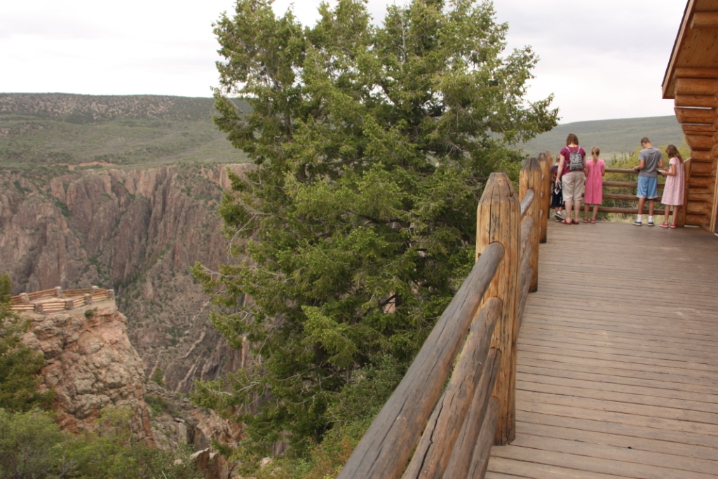
We were awed by our first glimpse of the Canyon at Tomichi
Point; it is insanely steep and extremely narrow and an incredible 48 miles in
length! We stopped in at the Visitor Center to chat with the Ranger and
collect Junior Ranger books. From there,
we spent quite some time at Gunnison Point completing the books and learning
about the Canyon and its history. The
shapes in light colors cutting through the cliffs were created by magma.


From the brochure: Slow, continuous, unyielding erosion formed the canyon, drop by drop and flood by flood. Rockfalls and landslides play occasional roles. The river first set its course over soft volcanic rock. It then cut down to harder, older crystalline rock of the dome-shaped Gunnison Uplift. Once entrenched in its course, the river had to keep cutting through this hard core for two million years. The Gunnison River now carves its Black Canyon more slowly because dams upstream lessened seasonal flooding. Undammed, the river used to slam through this gorge in flood stage at 12,000 cubic feet per second with 2.75 million-horsepower force, dramatically scouring the riverbed and eroding canyon walls.

We needed to visit two more points on South Rim Road to complete the JR program but the Ranger took our word that we’d head there next as the Visitor Center would be closing soon. The kids laughed because they knew very well that they would be visiting many more than those two points in the next couple of hours! Ranger Eric swore them in and asked about our trip. He told us that his Dad is currently in Denali National Park and prepping to climb Mount McKinley in the course of the next three weeks – how cool! Clearly National Parks are where active families head to work and play – something in our kids’ future perhaps.

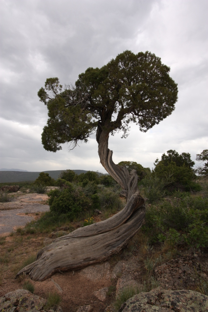
As we continued our journey along South Rim Road, we stopped at various
overlooks admiring the incredible rock formations and beautiful wildflowers: Rock Point, Chasm View, Painted Wall View, Dragon Point, and Sunset
View to name but a few!


On the way back, just before leaving the Park, we checked out
Pulpit Rock Overlook.

Given that we were rather fed up with bringing dinner/lunch
with us, we actually treated ourselves to Pizza Hut – ahh, the wonders of
someone else cooking! On the way back to the campground, we spotted this RV place - our wonderful friend and neighbor is Bob Scott - given that we are desperately trying to persuade him to buy an RV, as yet to no avail, maybe when he sees this..............


Comments