Colorado National Monument
After school, we left Dave to work and drove up the
supremely winding road to Colorado National Monument’s Visitor Center. We collected Junior Ranger books and despite
temperatures in the 90’s, we completed the one mile, self-guided nature
trail. There were some great little
paragraphs of information. We learned
about a variety of plant life, in particular pear cacti and juniper trees. This one died at the grand old age of 300
years and will take at least 100 years to slowly decompose, providing food and
shelter for numerous critters.


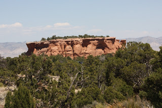
The reddish-orange cliff walls are Wingate Sandstone and
former sand dunes. Over millions of
years, winds blew the sand until they grew little by little. There are a number of ridges created by winds
of different directions. These rocks are
highly susceptible to erosion and weathering, so we could see plenty of
overhangs and holes. At the end of the
trail, we stood in a ‘room’ created by wind erosion. Walking carefully on the path, we took care
not to ‘bust the crust’ – this is the delicate hard top covering on the soil to
the sides of the path which takes moments to break but years to form.


As we hiked along, we spotted a number of collared lizards. We read about and saw, hidden under the rock
ledge, the left-behind nest of a woodrat as well as some tiny lionant
traps. Apparently there were Desert
Bighorn Sheep in the park; however, sadly we did not see any again! The Ranger told us that they had been spotted
on the Rim Rock Drive
to the west earlier in the morning – exactly where we drove in, there was
definitely no sign by the time we passed through.


We followed cyclists down the steep road back to Fruita,
spent some time working on the Junior Ranger programs, and returned to the Park
in the afternoon with Dave.

We headed through the West Entrance, stopped at Balanced Rock View, and continued on through the rock tunnels.


We headed through the West Entrance, stopped at Balanced Rock View, and continued on through the rock tunnels.


The Fruita Canyon View gave us an incredible view over the
valley.


From the Visitor
Center, we hiked the mile
Canyon Rim Trail to Book Cliffs View jumping every time a lizard ran across the
path! We were afforded more wonderful
views.


Having completed the two required hikes and far more
activities than necessary, the kids were sworn in as Junior Rangers once
again.


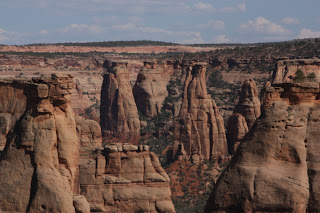
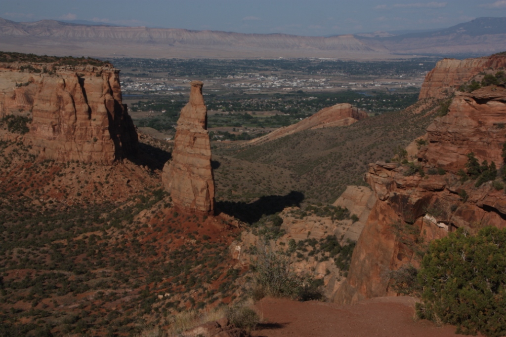
The famous Independence
Monument was our next
stop along the Drive. From the brochure:
This was once part of a massive rock wall
that separated Monument and Wedding
Canyons. Slowly, as the forces of erosion enlarged the
canyons, the dividing wall was narrowed and weakened. Weathering and erosion proceeded more rapidly
in places where the rock was most vulnerable – along natural fractures. Eventually the wall was breached and parts of
it collapsed. A remnant of the once
solid rock wall survives as Independence
Monument, a free-standing
monolith. It too will eventually succumb
to the ravages of time and weather.
We continued along the Rim Rock Drive, stopping at a number of
the overlooks including Coke Ovens Overlook and Artists Point, apparently good
for seeing sheep, naturally none there when we were!

Moving around to the east side of the Canyon, we viewed Upper Ute
Canyon and Red Canyon
Overlooks. It was incredible to see the
Fallen Rock, huge chunks of rock literally dropped from the side of the
cliff. We commented that it must have
made quite a noise when it fell!


The very end of the Drive took as toward the East Entrance
where we paused at Devils Kitchen Picnic Area for dinner. We returned to Fruita via the more flat roads
outside of the Park.


Comments